
Introduction
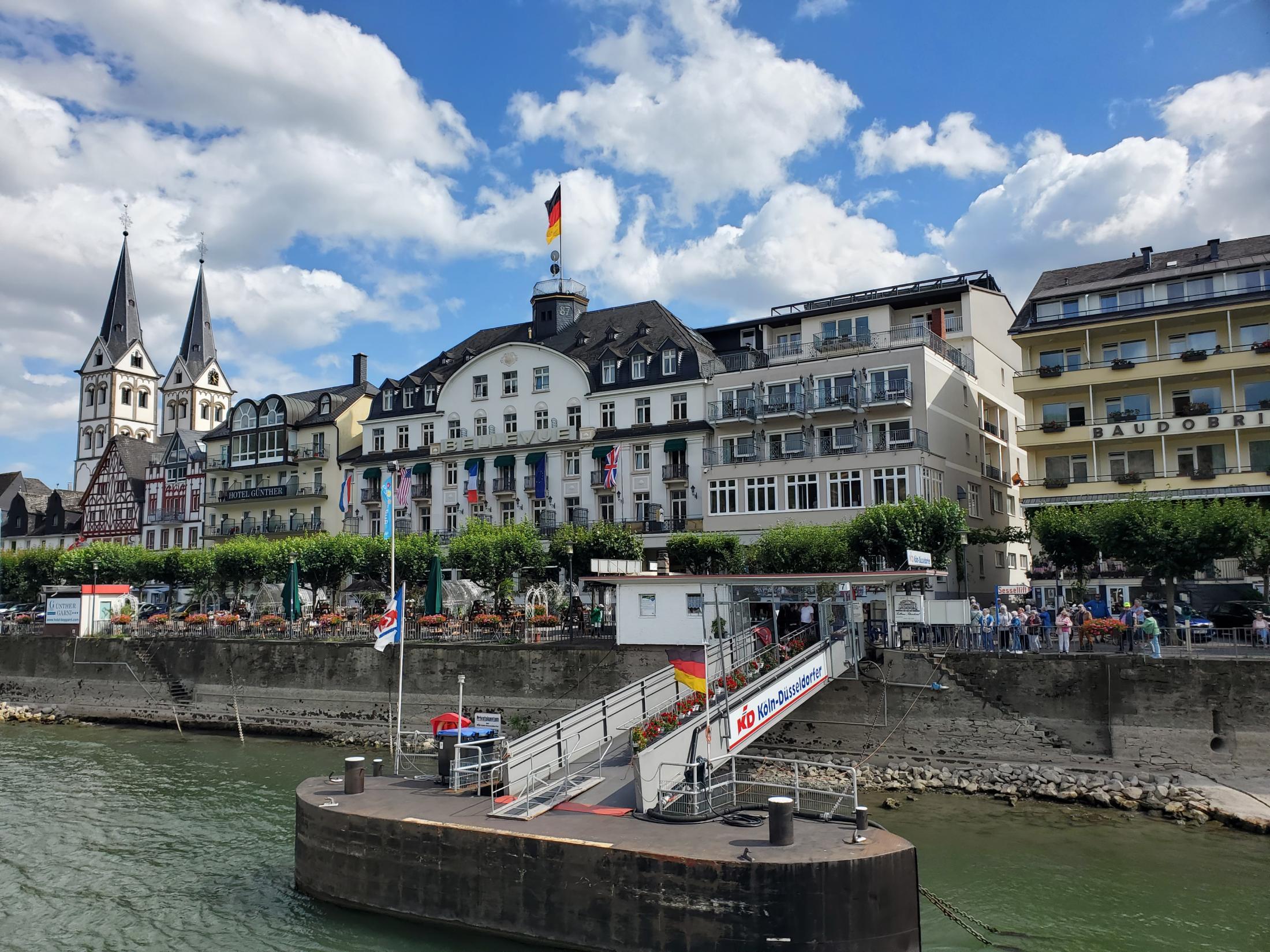
In July 2023, eight transdisciplinary US graduate students and several mentor professors participated in a two week field excursion to California, Germany, and the Netherlands. Our advanced studies institute was convened by World Water at UC Davis, in partnership with IHE Delft and supported with funds from the National Science Foundation’s International Research Experiences for Students (IRES) program. While visiting the Rhine River Basin in Germany and the Netherlands and the Sacramento River Basin in California, we met with flood managers, toured flood management infrastructure, and learned about the people and ecosystems impacted by flooding. Our objective: study transboundary flood risk management paradigms to identify parallels and global lessons for enhancing flood risk mitigation and the protection of vulnerable communities.With a length of 1233 km, the Rhine River starts in the Alps and passes through nine countries before emptying into the North Sea, making it one of the largest and most important rivers in Europe. The Rhine River has a rich history as a vital transportation route and still serves that role today, with a deep dredged channel allowing boats passage. The river is prone to seasonal flooding, which has caused significant damages to infrastructure, property, and human lives, most recently in 2021. Over the years, various flood risk management measures have been implemented along the Rhine to mitigate these risks and safeguard surrounding communities. Flooding along the Rhine has been tackled in a combination of structural and non-structural measures. Structural measures include the construction of dams, levees, and flood control channels, while non-structural measures refer to land use planning, floodplain zoning, and ecosystem-centered methods. Transboundary cooperation and active stakeholder engagement are essential for effective flood management decisions in the shared catchment.

The Sacramento River is located in northern California in the United States. Compared to the Rhine River, the Sacramento is notably smaller. The Sacramento River serves as a valuable source of agricultural and municipal water. Precipitation in the Sacramento Basin is highly seasonal, primarliy falling in the winter months while water demand is highest during the summer growing months. Additionally, the region experiences a boom and bust cycle of water availability, with drought years intermixed with wet years. Therefore, water is stored in many dams and reservoirs within the catchment. Similar to the Rhine, heavy flooding remains a complicated problem that has seen a necessary evolution of management strategies including structural and non-structural measures.
While the Sacramento and Rhine River basins both crucially support human and ecological communities, they vary in scale, hydrologic usage, and flood management approaches. The larger Rhine River basin is home to 54 million people, an order of magnitude greater than the 2.8 million residents in the Sacramento basin. The dominant water use also differs between the two basins, with the Rhine used primarily as a riverine transportation corridor while the Sacramento primarily serves as a source of agricultural and municipal water supply. Consequently, the Rhine River has very few dams so as to remain nagivable while the Sacramento River has many dams to store water for downstream use. For all their differences, both regions are prone to heavy seasonal flood events that have high potential economic effects and loss of life. Comparing the evolution of flood mitigation activities over time across both settings allows us to break down flood management paradigms and better prepare for a changing future. Both catchments exemplify the ongoing challenges and opportunities in managing a vital waterway in a highly populated and dynamic region. By implementing innovative approaches and incorporating lessons learned from past experiences as well as other basins, communities in the Sacramento River Basin can better understand what has worked in the past, and what may work in the future.
Management and Mitigation

The mid-1900s were the end of the major period of water supply infrastructure construction (e.g, reservoirs, levees and canals) to control the flow of water in the Sacramento Valley coming from the Sierra Nevada. With the majority of this region’s precipitation falling during the winter months, snowpack and a system of reservoirs provide essential storage for generating streamflow during the highest water demand over the summer growing season months. These multipurpose flood control and water supply infrastructure require redesign and repairs after major floods that cause damage or indicate potential failure in future storms.
Major floods in the period following resulted in the need to repair damaged flood control infrastructure on the local scale and resulted in changes in flood operation procedures or redesign of infrastructure on individual projects (e.g., Folsom Dam flood rule changes after 1986 flood). The first Central Valley Flood Protection Plan (CVFPP) published in 2012 led to the Central Valley Hydraulic Evaluation which identified the need for improved hydraulic modeling and flood mapping of the Central Valley. The CVFPP also identified the need for improved flood management structure coordination, adaptation of reservoir operation rules, the construction of levee setbacks, and conjunctive use to reduce flood peaks and recharge groundwater. By the floods of 2017, Managed Aquifer Recharge (MAR) was implemented by several local agencies to contribute to groundwater sustainability with permitting controlled by the State Water Resources Control Board. During the extreme flooding of 2023, the Department of Water.
Resources and the National Weather Service were forecasting with support from federal agencies to assist local emergency response decisions. An executive order allowed for the diversion of flood flows during emergencies to intentionally flood fields for groundwater recharge. The U.S. is also exploring applications of forecast informed reservoir operations (FIRO), which allows water managers to retain or release more water based on advanced forecasting technology and reservoir modeling, creating more of a buffer for floods.
Major Rhine river floods occurred in 1993 and 1995. In response, the International Commission for the Protection of the Rhine implemented the Action Plan on Floods in 1998. This was integrated into the more general Rhine 2020 program in 2001. This program was furthered with the EU Flood Directive implemented in 2007, which requires regular International Flood Risk Management Plan (IFRMP) reports that detail flood management by all countries.
Rhine 2020 invested fourteen billion euros towards improving flood risk management in the Rhine basin, making progress towards goals. Funds from the project have been used to raise flood awareness, including by publishing Rhine Atlas flood risk maps for public use. Flood forecasting has improved by doubling forecast periods since 1995. Flood risk has been reduced by 25%, including through “room for the river” measures to hold back more water during high flows. Projections of climate change impacts on discharge through 2100 were used to develop an adaptation strategy for the Rhine, which was published in 2015. Further goals for climate resilience and environmental sustainability have been set for Rhine 2040.
Ecology
The Yolo Bypass, a “multi-benefit” flood mitigation measure, is an example of successful nature-based flood management. In addition to flood water diversion, it provides a number of additional benefits to society such as salmon spawning habitat, migratory bird habitat, and natural water filtration. In recent history, flood management in the Sacramento basin has largely relied upon traditional environmental engineering such as levee improvements and dam construction; however, the recent past has seen a shift towards holistic, multi-benefit floodplain considerations that shift towards a harmonious human-ecosystem relationship. Equity and a focus towards protecting vulnerable communities has been a key part of the California floodplain restoration paradigm.
The so-called “New Year’s Floods”of 1997 forced a break in the west levee of the Sutter Bypass, inundating a number of communities. This event led to the California Natural Resources Agency issuing the Flood Emergency Action Report, which emphasized floodplain expansion and management as mitigation strategies. At this point, multi-benefit approaches begin to come to the forefront of floodplain management policy in earnest; several levee setback projects are enacted, mostly along the Feather River.
In 2005, Hurricane Katrina in Louisiana spurred country-wide flood mitigation efforts, including the eventual Central Valley Flood Protection Act that - codified in 2008 - expanded multi-benefit approaches. Following 2017 floods in the Sacramento river basin, levee setbacks increasingly became part of the management portfolio, including the Three Rivers setback, Natomas, Cache Creek, Cosumnes, Lower Elkhorn, and Yolo Bypass. The Central Valley Flood Protection Plan was edited to include more restoration-based projects. As atmospheric river floods in the winter of 2023 have been some of the most devastating in the basin, current justice and equity-centric levee setback endeavors in areas such as Grimes and Hamilton City protect and center vulnerable communities.
The catastrophic Sandoz chemical spill in the Rhine river in 1986 caused a huge and sudden increase in pollution and death of aquatic animals inhabiting the river. This event catalyzed Rhine basin countries in the ICPR to pass the 1987 Rhine River Action Plan (ICPR 1987), which proposed restoring river habitat to a suitable standard for native species to return by 2000 through restoring fish spawning grounds, improving water quality, and creating fish passage structures. In essence, it laid the groundwork for future policies to incorporate ecosystem benefits into Rhine Basin management. The next major event to impact Rhine basin policy were the 1993 and 1995 flood events which resulted in major damage to property and infrastructure. The Rhine Basin countries responded to these events in 1995 by agreeing to international coordination of Rhine River management that included a focus on environmental management strategies such as riverbank restoration, de-canalization, reduced pollution, reconnection of floodplains, and prevention of urban encroachment near the river (Wessel 1995). These agreements eventually lead to the 2001 creation of the Rhine 2020 plan, whose initiatives focused heavily on restoring the Rhine River ecosystem (ICPR 2020). The next major policy implementation with impacts to Rhine river ecology came with the 2007 EU Flood directive, which strove for a single flood management plan for all EU countries. This led the Netherlands to enact the Room for the River program, furthering the EU’s focus on Integrated River Basin Management (IRBM).
While there have been successes and failures in both basin approaches to multi-benefit flood risk management (FRM), the U.S. has prioritized the human dimension (e.g. equity for historically disadvantaged populations), while the EU has emphasized the importance of nature-centric solutions to flooding. As both basins move forward, there is room for growth and adoption of both aspects of these approaches.
Policy and Governance Structures
“Rivers flow across national borders unfettered by political distinctions, and the ecological health of rivers is closely linked to their degree of connectivity.” Integrated water resource management is necessary given the geology of watersheds, the hydrologic cycle, and the interconnectedness of ground and surface water. Yet, the US and EU have historically taken disjointed and fragmented approaches to FRM, managing flood risk locally and independently within a larger interconnected hydrologic system. These bottom-up approaches amount to a decentralized amalgamation of local and regional policies completely at odds with the hydrology of watersheds. In recent years, however, as globalization and climate change intensify, there has been an acknowledgement–both academic and professional–of the need for a more unified coordination of communities and regions connected by rivers and a subsequent move toward such integration.
Transboundary coordination is especially important for the Rhine River Basin, which passes through nine countries. What one country does upstream affects the river in all countries downstream. Yet, for much of the 20th century, flood risk management was left to individual communities within those countries. A series of catastrophic emergencies across Europe in the 1980s and ‘90s spurred increased coordination across Europe and in 2007, two Upper Rhine nations, France and Switzerland, called for a working group to develop a handbook on flood risk mapping. Later that same year, the European Union issued the European Floods Directive (EFD), initiating a primarily top-down approach to FRM in Europe. The EFD required all EU member states to develop hazard “risk maps” showing potential damage and update flood risk management plans every six years.

The Sacramento River Basin, by contrast, resides entirely within the borders of a single state in a single country. Despite this, given the US governance structure of “marble cake federalism,” the Sacramento River Basin’s flood risk management is governed by an astounding array of local, state, state-federal, and federal policies, regulations, plans, dams, weirs, and more. In 1917, the State Plan of Flood Control (SPFC) was federally authorized, and today it details the operation and maintenance of more than 1,600 miles of levees, five major weirs, four dams, six pumping plants, and numerous floodways, bypasses and drainage facilities in California’s Central Valley. In 1968, the National Flood Insurance Program (NFIP) was passed by an act of Congress. It insures individuals against flood losses but leaves flood management to individual states, again, despite the need for watersheds to be managed across borders. In 2008, in recognition of the need for still greater flood risk management than that provided by the state-federal SPFC or the federal NFIP, California passed the Central Valley Flood Protection Act which mandated that the Department of Water Resources (DWR) develop the Central Valley Flood Protection Plan (the Plan or CVFPP) to be adopted by the Central Valley Flood Protection Board (the Board). The Plan was required to include preliminary maps for the 100- and 200-year floodplains protected by SPFC levees, and the 100-year flood plain maps were to be prepared using criteria developed or accepted by the Federal Emergency Management Agency (FEMA). Together with many local flood management regimes, the state-federal SPFC, the federal NFIP, and the state-regional CVFPP manage flood risk in the Sacramento River Basin.